







Sale
Scandinavia 1826
Regular price
295 kr
Sale price
295 kr
Regular price
369 kr
Unit price
per
20%
off
Taxes included.
From the archive
From the archive
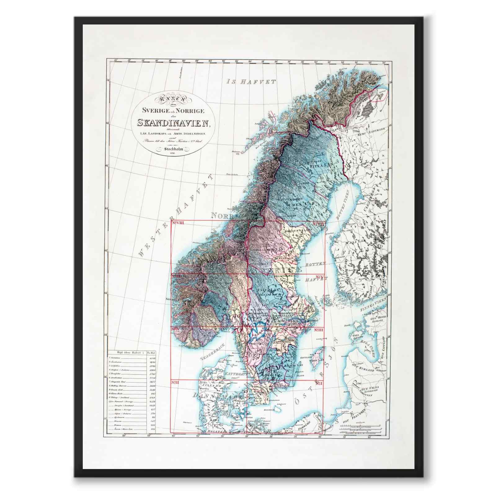
The map that was a key to another map
The sheet from 1826 served as a key to Carl af Forsell’s considerably larger map work, issued in eight sheets. Compiled on royal commission between 1815 and 1826, the entire project gave the Swedish-Norwegian union a shared geographical overview – with counties, provinces and Norwegian amt as its administrative building blocks.
Historly
4.9 average from thousands of reviews
1–3 day delivery time
Free shipping
The story behind the motif
Poster with a map of Scandinavia from the year 1826.
At the top left we see the text " Map of Sweden and the North or Scandinavia, Showing the County-Landscape- and County-Division, as well as the Plan to the Larger Map in the 8th sheet."
Illustrator: Carl af Forsell | Created: 1826.
Frame not included
Please note that the images are cropped slightly differently depending on the size you choose. Read more about image and image quality here: FAQ .
Complete the look:

Exclusive paper
Our posters are printed on 230 gsm matte museum-quality paper. The paper has a soft surface with a subtle texture and a warm tone that gives the motifs remarkable depth and rich color reproduction.